Posts

Showing posts with the label Raven adventures

Hot Spring (Maji Chemka

Image
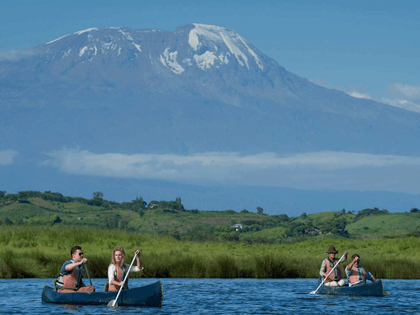
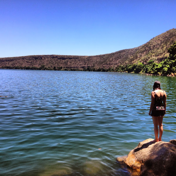
You will start your journey in Moshi at around 9 am by being picked up by our driver for your transfer to Kikuletwa village where the Hot Spring  (Maji Chemka) is located. You will spend the whole day there exploring the lake and the nature around – enjoy picnic lunch before driving back to Moshi. Activities: nature walk, swimming, bird watching.at boma ngombe moshi

#Shira cave on mountain climb mt Kilimanjaro

Image
#Shira cave on mountain climb mt Kilimanjaro with raven adventures we will make your of Kilimanjaro to be easy and you we will feel comfortable as well because we have an knowledge people, if your have a plan to visit Africa especially Tanzania you my lat as plan your trip with you, there's somany please to visit here in Tanzania like #ngorongoro conservation erea

Shira cave campsite

Image
Location of Shira cave campsite Like its name suggests, Shira cave campsite lies on the Shira plateau — one mount Kilimanjaro's three peaks. It also is in the heath zone of the mountain's western end. Short trees and shrubs make  much of the area's greenery, though there are a few outliers that grow to as much as 3 metres.with Raven  adventures 

Fauna and flora on Mount Kilimanjaro Kilimanjaro flora There are five distinct ecological zones on Kilimanjaro

Image
   by raven adventures  HOME CLIMBERS  BLOG    ENQUIRE Fauna and flora on Mount Kilimanjaro Kilimanjaro flora There are five distinct ecological zones on Kilimanjaro, each about 1000m in ‘height’. At 800m to 1800m you will find bush land with villages, farms and grassland. The next ‘level’ of vegetation is the dense rainforest at 1800m – 2800m. This lush green zone receives 1000 to 2000mm of rain yearly. You will see huge tree ferns, sycamore trees, junipers, as well as moss also known as “old man’s beard”. This humid zone is the perfect place for the multitude of plants, some of which are endemic like the “impatiens kilimanjari”. The semi-alpine heath and moorland zone is found at 2800m to 4000m. Here you will see the strange giant groundsel, Senecio trees, Lobelias and the colourful red hot pokers. The main source of the indirect precipitation in this zone comes in the form of mist which can envelope you without warning. Temperatures here can drop to 0°C....

machame geat

Image
machame geat we are going to start climbing  #mountain  Kilimanjaro macham e route weare going 7 days book your trip now with R adventure The trek begins at Machame Gate, located in the southern base of mountain, which is just a short drive from Moshi or Arusha. The hike starts within Kilimanjaro’s lush, fertile, montane rainforest. As you might expect, the lower slopes receive a quite a bit of precipitation. The trail may be steep and slippery, so trekking poles are advisedMay 25, 2021 · The first day trekking begins at Machame Gate (1,640 meters). Typically you will drive from the town of Moshi or Arusha to the gate, which takes approximately an hour for the former and two hours for the latter. On the way you will get to see subsistence farming and the town of Machame. 7 days or 6 days. https://raven-adventure.business.site

Photos of Mt Kilimanjaro

Image

Kinukamori waterfall/

Image
The Kinukamori waterfall is in fact integral part of Marangu village, and offers different look at the Chagga culture. On top of this waterfall you will be able to see a statue of a woman who, according to legend, became pregnant out of wedlock and decided to commit suicide by jumping from the top of #available at marangu Kilimanjaro

Lake Duluti

Image
Sep 16, 2015 · Lake Duluti is formed inside a volcanic crater and has water throughout the year, mainly from groundwater and seasonal rainfall. The crater is a subsidiary vent to Mount Meru (4566m) that towers over the lake.and you see mt Kilimanjaro nice view and  mt Meru  nice view too more information find us we may help you  https://ravensadve.blogspot.com/

Mweka Campsite (3106m)

Image
Today’s walk takes us back down through the alpine desert, heath and moorland zones until we once more enter the forest zone via Millennium Camp (3827m). There, amongst the trees, we find the Mweka Campsite (3106m), our final stop on the trek. We should arrive there at about 4pm – and you have been walking for around 16 hours, less breaks to go mweka geat

Mount Meru

Image
Mount Meru is a dormant stratovolcano located 70 kilometres west of Mount Kilimanjaro in the country of Tanzania. At a height of 4,562.13 metres, it is visible from Mount Kilimanjaro on a clear day, and is the fifth-highest of the highest mountain peaks of Africa, dependent on definition. and there many range animal like a #wild boar#Buffalo #monkey  #giraffe  and birds so meany thing to visit in momela area logs  book now don't miss . Location of Ngongongare gateNgongongare gate is located a short distance inside the south eastern border of Arusha national park, far from the rainforest that is chara cteristic of the park. Just a few minutes up north is the mini Serengeti - a small field where animals graze in the mornings

Lake Chala

Image
Lake Chala , also known as Lake Challa, is a crater lake that straddles the border between Kenya and Tanzania. The lake formed approximately 250,000 years ago. The lake is east of Mount Kilimanjaro, 8 kilometres (5.0 mi) north of Taveta, Kenya, and 55 kilometres (34 mi) east of Rombo District. The lake is surrounded by a steep crater rim with a maximum height of 170 metres (560 ft). Lake Chala's …for more information contact us Lake

Lake Chala,

Image
Lake Chala, also known as Lake Challa, is a crater lake that straddles the border between Kenya and Tanzania. The lake formed approximately 250,000 years ago. The lake is east of Mount Kilimanjaro, 8 kilometres (5.0 mi) north of Taveta, Kenya, and 55 kilometres (34 mi) east of Rombo District. The lake is surrounded by a steep crater rim with a maximum height of 170 metres (560 ft). Lake Chala's average annual rainfall is about 565 millimetres (22.2 in). The lake surface has an average annual evaporation of near 1,735 millimetres (68.3 in). Approximately 80 percent of the lake's inflow comes from groundwater, which is derived mostly from rainfall in the montane forest zone of Mount Kilimanjaro at an elevation of 1,800 to 2,800 metres (5,900 to 9,200 ft). It takes about 3 months for groundwater to reach the lake. The groundwater flowed into the lake at an estimated annual volume of 8,390,000 cubic metres (296,000,000 cu ft) from 1964 through 1977.

mountain. #meru

Image

Uhuru peak on mt Kilimanjaro

Image

Raven adventures service on mt #Kilimanjaro

Image
Our services are good and we have staff who understand that you will find something useful in your trip to climb Mount Kilimanjaro and Kungru adventure. If you have allergies to meat or anything else it will be under supervision and a diet planner very carefully, at all is a pleasure for us if you give us the opportunity to plan with you your trip with us raven  adventure

· Barranco Camp & baranco wall

Image
baranco wall Branco  camp  and jaunts snecio Kilimanjari Jul 17, 2021 · Barranco Camp Today the Kilimanjaro team left Shira Camp and traversed the mountain, working their way up to the base of “ The Lava Tower ” at approximately 14,800 ft. They made a quick ascent of the lava tower, a fun scramble up with great views from the top, then descended down to baranco and  weating till tomorrow to climb baranco wall